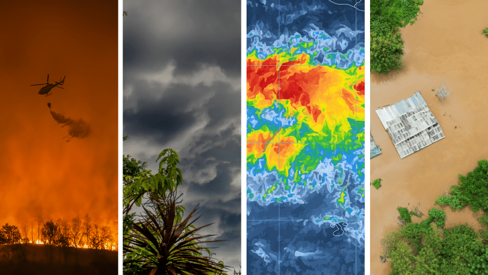
A Super El Niño — when tropical Pacific waters warm by more than two degrees Celsius above normal — doesn’t stay local.
The phenomenon ripples across the globe, shifting weather patterns from North Carolina to Kenya, triggering intense rainfall in some regions and devastating droughts in others. While smaller temperature anomalies happen regularly, a Super El Niño is rare: only a handful have occurred in recorded history. Yet forecasters predict one could emerge this year, potentially bringing more extreme precipitation, intensified evaporation, and cascading effects on agriculture, fishing and water security worldwide.
Risper Nyairo, assistant professor of environmental studies at Davidson College, helps us understand a Super El Niño. She studies climate change adaptation and socio-ecological vulnerability and teaches courses on weather, climate and oceanography. Her expertise is both academic and personal: she was growing up in Kenya during the flooding and devastation of the 1997-1998 Super El Niño.
She helped break down the science behind the phenomenon, explains how distant ocean temperatures influence our weather, and offers practical guidance on what communities should do to prepare.
What makes a “Super” El Niño different?
It comes down to how much sea surface temperatures shift from normal — and it’s not the whole ocean, it’s a specific, monitored location in the equatorial Pacific. When temperatures there rise about 0.5 degrees Celsius (roughly 1 degree Fahrenheit) above normal, that’s classified as an El Niño. Beyond that, it moves into moderate, then strong categories, and once the anomaly goes above two degrees, that becomes a Super El Niño.
And this year is forecast to cross that two-degree threshold?
Yes, currently that’s the forecast but nothing is confirmed yet. It’s similar to forecasting hurricanes: sometimes we think a storm will be a certain category and it ends up strengthening or dissipating. We can never be 100% certain.
Why would unusually warm water in the Pacific affect weather here in North Carolina?
That gets at what we call “teleconnections.” El Niño — more formally, ENSO or El Niño Southern Oscillation — is a system built on the interaction between the atmosphere and the ocean.
Normally, there’s an atmospheric pattern called the Walker Circulation: air descends near South America, flows west, rises over Australia and Southeast Asia, then flows back east at higher altitude. As it moves west, it drags surface water westward, pulling warm water toward Australia and leaving colder, nutrient-rich water to upwell off South America — part of why that region has such thriving fishing communities.
Where air is rising, you get low pressure, and the rising air cools and condenses to form rain; where it’s descending, you get high pressure and little precipitation. The weakening of the Walker Circulation results in an El Niño: warm water normally pushed west is instead retained further east. This shifts wet conditions toward the central and eastern Pacific. The jet stream shifts position too, bringing wetter winter conditions to the southern U.S., including central and eastern North Carolina.
Is that just an amplification of the normal pattern, or a reversal?
It’s a reversal of the Walker cell. If the opposite happens instead — the circulation strengthens and pushes even more warm water west — that's a La Niña, which brings colder-than-normal conditions. So there are three phases of ENSO: El Niño, La Niña and neutral.
Does a two-degree anomaly just make the same effects stronger than a half-degree El Niño?
Yes. Our oceans drive our weather, so if the water is two degrees warmer, the impacts are amplified: more evaporation, more precipitation in wet areas, and more extreme drought in others. That’s what gets called an “extreme event.”
Historically, how significant is a two-degree change?
There have been other Super El Niños. This would be the fifth or sixth on record. The one I remember personally was 1997-1998, when I was growing up in Kenya. That caused a lot of flooding and even deaths in my country.
The significance is tied to the thermal inertia of the oceans: oceans resist temperature change much more than land does, so a two-degree anomaly is a big deal precisely because it’s rare.
Are Super El Niños becoming more frequent because of climate change?
I want to be cautious here, because ENSO is a periodic pattern. We expect to see it every two to seven years and it’s primarily rooted in the equatorial Pacific, even though it has impacts worldwide. There is no evidence that climate change increases the frequency or intensity of El Niño events.
What we do know is that if we’re seeing very high sea surface temperature increases (as is the case with a super El Niño), something tied to rising global temperatures is probably driving that. But because El Niño operates on a two-to-seven-year cycle and climate change is measured over roughly 30 years, it’s hard to directly attribute changes in El Niño strength to climate change without some scientific analysis. Still, even without a Super El Niño, rising sea surface temperatures are a sign that the climate is changing.
What should people and communities do to prepare?
They should not despair. ENSO comes around periodically. What’s needed are vulnerability assessments: communities should look at what’s exposed to ENSO impacts, for example low-lying homes near flood-prone coastlines or rain-dependent agriculture, and implement “climate-proofing” accordingly. In the U.S., especially the southern U.S., that mostly means preparing for more winter precipitation and in North Carolina (based on my experience this past winter), better preparedness for more snow if it happens to fall. In drier locations like Australia, it might look more like planting different (drought-tolerant) crops or storing water for use during drought conditions.
Could all that added moisture also intensify hurricane season?
Actually, no. Historically, it works the other way. El Niño years tend to strengthen upper-level winds, which disrupt or slow hurricane development rather than fueling it. There’s also limited overlap in timing: hurricane season runs roughly June through September, while El Niño’s effects are usually strongest in winter.
When will we know how strong this Super El Niño will actually be?
It typically intensifies through the winter and becomes most apparent around December — which is where the name comes from. “El Niño” is Spanish for “the boy child,” a reference to the Christ child, because the pattern tends to show up around Christmas time. Right now predictions show a 81 percent chance for a very strong El Niño October through December 2026.
Is there anything else people should understand about this phenomenon?
Two things. First, we’re only monitoring a small portion of the ocean — the tropical Pacific — so while past El Niños have preceded warmer years, that doesn’t mean we can assume that 2027 will be a record-breaking hot year. However, a strong El Niño coupled with global heating could deliver the hottest year on record.
Second, it’s important to distinguish between weather and climate. El Niño is fundamentally a weather event, playing out over months, not the 30-year timescales we use to describe climate. Until the evidence is clear, I wouldn’t want people to conclude that our climate is changing in a way that guarantees more frequent or more severe Super El Niños going forward. There is a link, but also there is a lot about ocean-atmosphere interactions we still don’t fully understand.